Across Asia
Japanese Buddhist Cartography Across Five Centuries
1364–c. 1865
Follow six maps from 1364 to the early Meiji period as sacred geography meets changing cartographic knowledge.
1364: a spiral lake inside the Five Indias
The Hōryūji map of 1364 is the earliest surviving object in this Japanese lineage. Within its sacred geography of India, an interior spiral lake sends out four major channels. The motif gives water a powerful visual centre among pilgrimage places and Buddhist history.
A 1402 Daigoji handscroll places a separate Anavatapta diagram within a larger sequence of maps and cosmological drawings that includes Japan, India, Mount Sumeru, and heaven.
At a glance
- 1364
- Earliest surviving map in this lineage
- 6
- Objects followed across the study
- 5 centuries
- Continuity of the tradition
- 4
- Channels from the spiral lake motif
1710 and 1749: new geography enters the picture
Hotan’s 1710 map absorbs geographical information arriving from Europe while continuing to organize India through Buddhist places. A 1749 map now in Kobe keeps the spiral lake and its four outlets amid a dense network of red routes.
These maps do not abandon sacred geography when coastlines and world knowledge change. They find new ways to hold old places and new information together.
1828 and beyond: continuity through reinvention
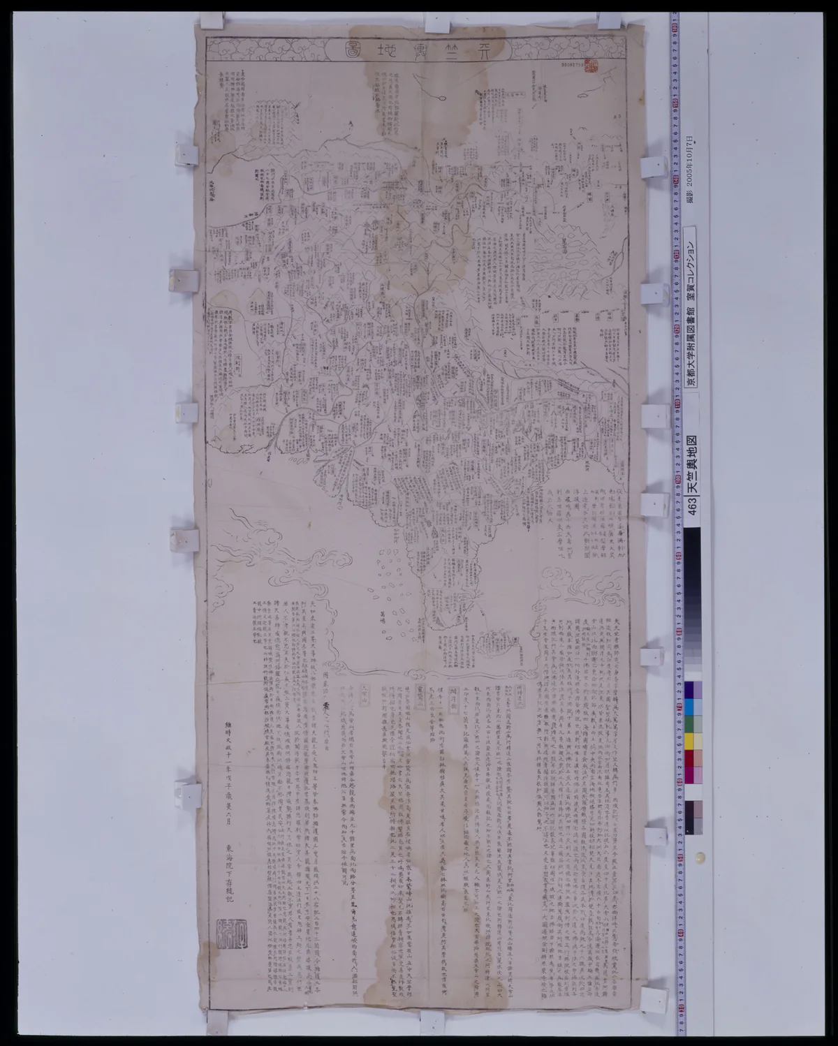
A Kyoto map of 1828 preserves Buddhist annotations and a whirlpool-like water centre within a dramatically revised outline of India. An early Meiji map at Ryukoku University continues the Five-Indias tradition into another period of geographical change.
Across five centuries, the lake survives not as a mechanically copied symbol but as part of an active Japanese practice of thinking about India, Buddhism, travel, and the world.
Six moments in a changing map traditionOpen the comparison.
Six moments in a changing map tradition
| Date | Object or setting | Transformation |
|---|---|---|
| 1364 | Hōryūji Five Indias map | Spiral water centre within Buddhist India |
| 1402 | Daigoji handscroll | Anavatapta diagram among maps of Japan, India, Sumeru, and heaven |
| 1710 | Hotan map | European geographical information enters |
| 1749 | Kobe map | Spiral lake remains amid dense red routes |
| 1828 | Kyoto map | Revised Indian outline with whirlpool-like centre |
| Early Meiji | Ryukoku map | Lineage continues into modern geographical change |
Six maps across five centuriesJapanese Buddhist maps preserve a hydrological centre while repeatedly redesigning India around it. Their sequence shows new geographical knowledge entering without instantly erasing sacred routes.
1364 · 177 × 166.5 cm
Hōryūji Gotenjiku zu
An ovoid India contains an upper-central spiral lake, four broad blue channels, and red routes. The public-domain object is the earliest surviving map in this followed lineage.
1402
Daigoji handscroll
A separate Anavatapta diagram uses four differentiated animal-associated outlets alongside maps of India, Mount Sumeru, heaven, and Japan. The manuscript should not be rehosted without permission.
1710 · 118 × 148 cm
Hotan’s printed world map
European geographical information enters a printed Buddhist world map. The object is reusable under National Diet Library terms, but a specific Anavatapta label has not been verified.
1749
Tenjiku no zu at Kobe
An ovoid India retains a spiral lake, four outlets, and dense red routes. Current access supports research comparison, not self-hosting of the preview.
1828
Tenjiku yochizu at Kyoto
A more European-shaped India still carries Buddhist annotations and an Anavatapta whirlpool. The coastline changes more rapidly than the sacred centre.
c. 1865
Ryukoku Gotenjiku no zu
The Five-Indias form and hydrological centre continue into the early modern encounter with Japan and newer geographical knowledge. The available image remains for private research use.
Notes and further readingPassages, pages, objects, and books for anyone who wants to go deeper
In the sources
Details you can look up
These short notes lead directly to the texts and objects used in the guide.
-
Artwork or manuscriptView source
1364 and 1402 objects
The 1364 Hōryūji map has spiral lake/four-channel topology; the 1402 Harvard/Daigoji scroll has a discrete Anavatapta diagram in a multi-diagram Buddhist cosmos.
Where to find it: RJ:JBC-CLM-001–006; object registry
-
Artwork or manuscriptView source
1710, 1749, 1828 sequence
The 1710 Hotan, 1749 Kobe, and 1828 Kyoto objects retain and transform Buddhist water-world forms alongside changing geographic frames.
Where to find it: RJ:JBC-CLM-007–012; object registry
-
Artwork or manuscriptView source
Early-Meiji continuation
The early-Meiji Ryukoku map continues the reviewed sequence with Five-Indias form, hydrological centre, Japan, and newer information.
Where to find it: RJ:JBC-CLM-013–015
Further reading
Books, texts, objects, and studies
-
Artwork or manuscript1364 to early Meiji
Japanese Buddhist cartography object registry
1364 Hōryūji; 1402 Daigoji/Harvard; 1710 Hotan; 1749 Kobe; 1828 Kyoto; early-Meiji Ryukoku
A six-object historical sequence selected and reviewed as individual maps, not a single generic Japanese tradition.
Keep this story
Save it on this device or send it to someone curious.